


News
A new wave of tsunami hazard data
Published:5 November 2018
A new wave of tsunami hazard data
Geoscience Australia today released the 2018 update to the Probabilistic Tsunami Hazard Assessment (PTHA), which outlines the tsunami hazard for all of Australia and its offshore territories.
The release of the 2018 update to the PTHA coincides with the United Nations' World Tsunami Awareness Day, which aims to raise community awareness of tsunamis and share innovative approaches to risk reduction.
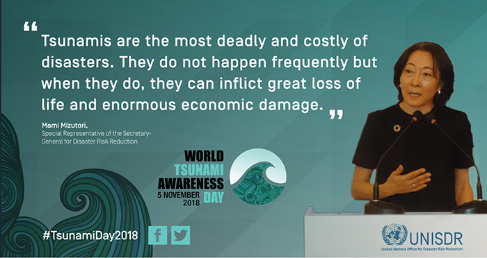
Special Representative of the Secretary-General for Disaster Risk Reduction Mami Mizutori speaks about tsunami hazard.
The PTHA includes data for more than half a million earthquake-tsunami scenarios in Australia.
Geoscience Australia hazard modeller Dr Gareth Davies, who led the project, said the latest assessment reflects improvements in science and technology, and includes insights gained from tsunamis that have occurred since the last update a decade ago in 2008.
"The 2018 update reflects advances in our understanding of how frequently large earthquakes that can cause tsunamis occur and the uncertainties in these frequencies," Dr Davies said.
"Additionally, it has data for more locations around Australia. This will make it easier for modellers like me to conduct local tsunami studies, including for major Australian offshore islands and territories.
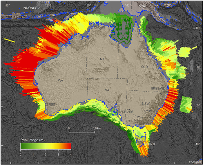
Probabilistic Tsunami Hazard Assessment map.
"The new methodologies in the 2018 update have been tested using 10 years of deep ocean tsunami observational data from the Pacific Ocean to confirm they give a realistic depiction of tsunami behaviour.
"This data will allow us to more accurately estimate the predicted tsunami hazard for specific locations. It was not included in earlier updates, as most of the tsunamis in the test-set occurred after 2008."
Dr Davies said although most people did not think of Australia as being vulnerable to tsunamis, there have been more than 50 recorded incidents of tsunamis affecting the Australian coastline since European settlement. Most of these tsunamis resulted in dangerous rips and currents rather than land inundation.
"Tsunamis that affect the Australian coast are caused by subduction zone earthquakes in the Indian and Pacific Oceans. Subduction zones are tectonic plate boundaries where two plates converge and one plate is thrust beneath the other.
"In Australia, the northwest coast in Western Australia is more likely than the east or southwest coast to experience a tsunami due to its proximity to the Indonesia tectonic plate boundary, which has a long, seismically active fault line," Dr Davies said.
"The Geraldton marina in Western Australia received damage during the 2004 Indian Ocean tsunami, which occurred in Indonesia. Impacts were also felt in the Oman port, near the Persian Gulf, which was over 6,000 kilometres from the earthquake epicentre."
Dr Davies said the local tsunami studies derived from the 2018 PTHA will inform evidence-based disaster management and evacuation plans, as well as infrastructure planning and mitigation strategies.
"Currently, the Joint Australian Tsunami Warning Centre operated by Geoscience Australia and the Bureau of Meteorology ensures that all Australians have at least 90 minutes of warning time to take action.
"The PTHA is the first step in gaining a better understanding of the tsunami hazard for specific locations around the Australian coast and how we can reduce the vulnerability of those communities to the impact of tsunamis."
Further information:
- Probabilistic Tsunami Hazard Assessment
- Media release from the Minister for Resources and Northern Australia
- Joint media release with the Bureau of Meteorology about the Joint Australian Tsunami Warning Centre
- Australia's Probabilistic Tsunami Hazard Assessment - a valuable tool and a Sendai good practice
Contact:
Phone:
Email: