


News
New Bushfire Toolbox supports better building design
Published:6 June 2016
New Bushfire Toolbox supports better building design
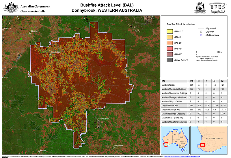
A Bushfire Attack Level analysis of Donnybrook,
south-western Western Australia
Fire is a natural feature of the Australian landscape and remains an ever-present threat. Understanding the risk and potential impacts of bushfire can help communities make better decisions to prepare for, and mitigate against, these risks.
Local government, emergency managers and communities will now be able to better understand the potential exposure of buildings to bushfire, based on local topography and vegetation cover thanks to a new Bushfire Attack Level Toolbox developed by Geoscience Australia with support from the Western Australian Department of Fire and Emergency Services.
Geoscience Australia hazard modeller Craig Arthur said the new open source GIS software will help planners and emergency managers prepare targeted Bushfire Attack Level analyses in bushfire prone areas, and help their communities become better prepared.
"The new tool will be used by emergency management authorities for pre-disaster season preparation activities such as hazard reduction burns. It could also be used by architects, building engineers and accredited bushfire hazard assessors to help design buildings that are better protected from bushfire attack," explained Mr Arthur.
"It can be used to evaluate and map potential exposure of buildings to bushfire, taking into consideration the Fire Danger Index, slope of the land, types of surrounding vegetation and their proximity to buildings; and also considers potential ember attack, the effect of radiant heat or direct flame attack," Mr Arthur added.
The ArcGIS Toolbox supports implementation of the Australian Standard 3959 (2009) Construction of buildings in bushfire-prone areas. The Standard describes how to measure the bushfire attack level for any location and establishes the requirements to improve the design of existing or planned buildings and therefore increase protection from bushfire attack.
The Toolbox can be downloaded from Geoscience Australia's website.Further information:
- Value to the Nation: Ensuring Australia's Community Safety
Contact:
Phone:
Email: