


News
Australia’s world-leading precompetitive geoscience looking deep undercover
Published:5 March 2021
Australia’s world-leading precompetitive geoscience looking deep undercover
While the Australian Government’s Exploring for the Future program is successfully driving economic benefits, the internationally recognised science behind it is also some of the first of its kind.
While the Australian Government’s Exploring for the Future program is successfully driving economic benefits, the internationally recognised science behind it is also some of the first of its kind.
The Exploring for the Future program, which is being led by Geoscience Australia, is tackling the search for minerals, energy and groundwater resources head-on by providing multi-disciplinary, world-leading science for governments, industry and resource managers.
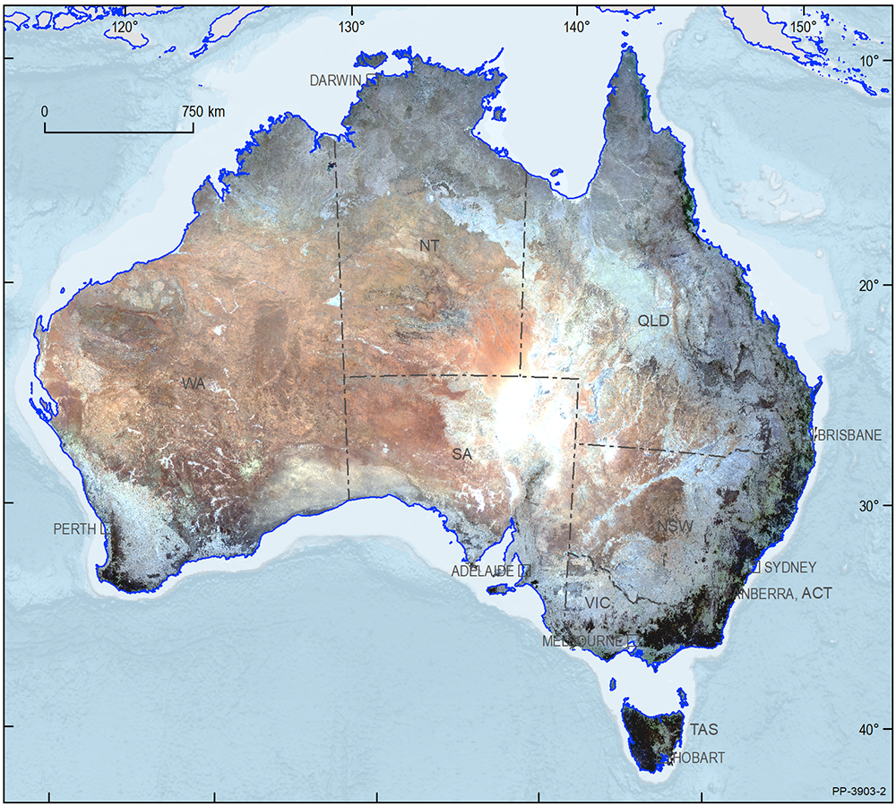
During the first phase of the program from 2016-20, Geoscience Australia staff utilised skills and technical capabilities in geology, hydrogeology, geophysics, geochemistry, data analysis and information technology to map over three million square kilometres of northern Australia.
The program has so far released 250 new datasets and reports, along with more than four terabytes of data—the equivalent of around two million images taken on a smartphone. This wealth of scientific data is openly available to explorers, researchers and the community, with more to come.
Over the next four years, the $225 million program will progress from northern Australia to the south, applying a range of well-established and also novel geoscience techniques and developing their applications even further. These integrated, multidisciplinary datasets will build a better understanding of the Australian continent, with wide-ranging applications and benefits across multiple sectors.
We know that 80 per cent of the Australian continent is underexplored, with some of the best geology containing mineral, energy and groundwater resources hidden under a blanket of younger sediments. That is why a key focus of the Exploring for the Future program is using different scientific techniques – at a scale never seen before – to understand what lies below this cover. This approach will help to identify new mineral, energy and groundwater resources that will benefit communities, local industry and the environment.
The approach of using and integrating geophysical, geochemical and machine learning techniques has helped to make startling and significant scientific findings, as well as narrowing down the search areas for new discoveries.
Key scientific achievements from the Exploring for the Future program are described in a collection of Extended Abstracts published in 2020. A selection of the most intriguing and important scientific results is outlined below.
Case study 1:
Continent-scale view of sediment-hosted base metal deposits using passive seismic data
A world-first scientific development from the Exploring for the Future program is the discovery that tectonic plate thickness controls the location of base-metal deposits in sedimentary basins — considerably narrowing down the search space for these deposits.
As part of the Australian Passive Seismic Array Project (AusArray), Geoscience Australia collaborated with state and territory geological surveys and academia to measure the time it takes for seismic waves from earthquakes to travel across the continent. Variations in temperature at different depths control how quickly these waves propagate through the Earth. Scientists used these variations in seismic wave travel time to model the temperature of the Australian plate and map its thickness. They then calibrated their models by analysing the composition of fragments of the plate brought to the surface by ancient volcanic eruptions.
The combined data allowed scientists to better understand the physical properties of the Australian plate from depths of a few metres down to hundreds of kilometres.
Working with researchers at the Australian National University, Harvard and Columbia Universities, and Imperial College London, Geoscience Australia’s scientists were able to show that 85 per cent of the world’s sediment-hosted base metal deposits, including all giant deposits, can be found along the edges of thick portions of tectonic plates.
Combining insights from this study, first published in Nature Geoscience, with the location of suitable rocks indicates that around 15 per cent of Australia is highly prospective for giant sediment-hosted mineral deposits. This knowledge greatly assists explorers focus their efforts in the most suitable areas while also revealing new regions that were previously overlooked.
The AusArray project has benefitted from key international scientific collaborations and demonstrated how to undertake projects on a continental scale. Consultation also shows that industry and government stakeholders are using these results as a basis for further studies and new exploration.
This project is an important step in implementing priorities for pre-competitive geoscience data collection and knowledge generation set out in the UNCOVER Roadmap, an initiative that brings together researchers in industry, governments and academia, to explore and uncover Australia’s hidden mineral wealth.

A heat map showing areas with a high potential for hosting sediment-hosted copper, zinc and lead deposits. This map is based on the discovery that all giant deposits of this type, in Australia and the world, are found along the edges of thick portions of tectonic plates (see Exploring for the Future Extended Abstracts).
Case study 2:
Stripping the Earth bare using machine learning
Through the Exploring for the Future program, Geoscience Australia is employing a range of new techniques to increase the suite of exploration and precompetitive data available to industry and the science community. One lesser-known technique that is being rapidly adopted is the application of machine learning to analyse satellite imagery to seamlessly map the Earth’s soil and rock cover.
In 2018, researchers from Geoscience Australia and the Australian National University (ANU) collaborated on a project to create the first single cloud-free image of Australia’s soil and rock cover, combining thousands of satellite images acquired over several decades.
The Barest Earth image and algorithm, which is now published in the journal Nature Communications, removes seasonal vegetation changes from satellite imagery. The resulting map provides an even more accurate picture of the physical composition of the surface.
This innovative method to map surface mineralogy and chemistry from space allows the mining industry and researchers to better understand the mineral potential in areas of interest. It also enhances geological mapping, digital soil mapping, and helps to establish baselines from which environmental change can be monitored.
Now that this technique is in place, the information and tools are being used by others to create more accurate Barest Earth products.
The freely available continental-scale Barest Earth image can be combined and modelled with other datasets using a customised set of machine learning tools called Uncover-ML. The Uncover-ML machine learning pipeline was developed by Geoscience Australia and the CSIRO. Machine learning is an important tool for synthesising and modelling the increasing complexity and sheer volume of geoscience data being generated.
For example, scientists have also combined the Barest Earth image with analyses of new and legacy soil samples to infer copper concentrations in soils in the Tennant Creek region of the Northern Territory, which is already being used by explorers to focus their exploration activities.
Researchers from the national research infrastructure project TERN and the CSIRO also recently worked with Geoscience Australia to make available thematic datasets to support improved mapping of soil and rock properties across Australia. This new data has application to the agriculture and natural resource management sectors.
Barest Earth image in true colour (RGB - bands 3, 2 and 1) revealing a greater proportion of exposed soil and bedrock. The Barest Earth algorithm removes seasonal green vegetation by weighting bare ground pixels or satellite observations acquired between 1985 and 2017.
Case study 3:
Drilling for an enhanced understanding of Australia’s geology
While innovations in remote sensing provide an enhanced understanding of the surface mineralogy and chemistry, at the end of the day, scientists still need to collect and analyse rock samples that help to visualise the Australia’s geology at depth and in three dimensions to confirm their models.
A key component of the Exploring for the Future program, involves Geoscience Australia and state and territory geological survey researchers, calibrating their geological modelling predictions through stratigraphic drilling techniques that are more efficient and less intrusive than ever before.
In 2019-20, Geoscience Australia and the Geological Survey of Western Australia, Department of Mines, Industry Regulation and Safety (DMIRS) collaborated on a deep stratigraphic drill hole in the South West Canning Basin in the Pilbara.
Exploring for the Future data from Australia’s longest onshore seismic line highlighted two specific areas of the onshore Canning Basin – the Barnicarndy Embayment and the Kidson Sub-basin – as having previously unrecognised mineral, energy and groundwater resources potential.
Barnicarndy-1 is the first stratigraphic drill hole drilled by Geoscience Australia since 1988 and, having drilled to a depth of 2680.5 metres, is one of the deepest and best calibrated drill holes in the region.
Following completion of drilling in November 2019, Geoscience Australia has provided enhanced descriptions of the regional geology to correlate the Barnicarndy Embayment with other wells in the Kidson Sub-Basin known to contain elements of energy systems. The program’s integrated analysis of both organic and inorganic geochemical properties has also been recognised as a gold standard for future studies of this kind.
The interpretive well completion report, to be released by DMIRS in June 2021, will provide baseline data on crucial rock units within the Canning Basin to underpin new energy exploration and assessment of sites for potential sequestration of carbon dioxide. All data released to date is available at in the Western Australian Petroleum and Geothermal Information Management System (WAPIMS) database.
The first stage of the world’s largest mineral exploration collaboration the MinEx CRC’s National Drilling Initiative (NDI) has also used knowledge gained from the Exploring for the Future program to target 10 drill holes in the East Tennant region and one deeper drill hole in the South Nicholson Basin in the Northern Territory.
This drilling campaign aims to investigate and map frontier regions for mineral, energy and groundwater exploration beneath the Barkly Tableland by understanding the fundamental geological framework of the region. Results from the first campaign were released on 4 March and are available here.
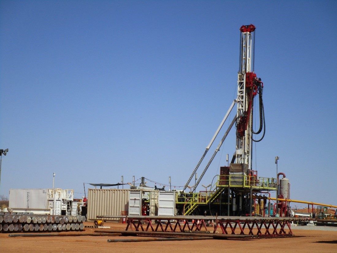
The Barnicarndy-1 drill site in the Pilbara region of Western Australia was identified based on data from the Exploring for the Future program from Australia’s longest onshore seismic line.
Where to next?
As it extends across southern Australia, the Exploring for the Future program will bring the various geographical and geological pieces of Australia together to contribute to a national view of our nation’s geology and mineral, energy and groundwater resource potential.
Geoscience Australia will continue to use novel data collection techniques to learn more about what lies beneath the surface of Australia. This world-leading science provides better ways to predict where mineral, energy and groundwater resources are located, particularly undercover and at depth.
Geoscience Australia’s scientific innovation and leadership during the Exploring for the Future program is also gaining international interest, with geological surveys from around the world looking to embark on their own domestic Exploring for the Future-style programs.
Integrated datasets acquired and developed during the Exploring for the Future program are available through Geoscience Australia’s Data Discovery Portal. The portal also provides access to cutting-edge 3D visualisation and analytical tools, so that this new data can be used by everyone to underpin scientific and resource discoveries across Australia.
More information: www.ga.gov.au/eftf
Contact:
Phone:
Email: